January to December 2005
Other years
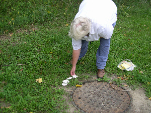
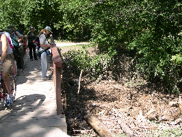
Sunday, December 18, 2 p.m. 2005, Market Streams. Meet SW corner Queen and Yonge. The streams have disapeared, but this is an historic part of the city: early schools, banks, post office and city halls. End at a coffee house. On city streets. Leaders Peter Hare and Ian Wheal. Attendance 37; -4C, overcast, light wind.
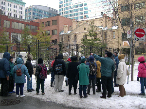
Group looking at Court House & Court Sq.
Saturday, December 10, 1:30 p.m., Taddle Creek. Start at St. Clair Ave. and Wychwood Avenues, SE corner. Leader Ian Wheal. Mostly on city streets. About two hours. Attendance 21, overcast, light wind, mild 1C.
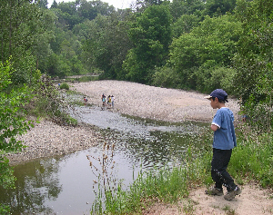
Sunday, November 20, 2005, 2 p.m., Mimico Creek. Start at Bishop Allen Academy parking lot on Royal York Road opposite Coney Road intersection. Ends on Royal York Road at Portland Street, two blocks north of the GO station. A little over 2 hours duration, mostly on paved surfaces with some park trails. Leaders Ed Freeman and Richard Anderson. Attendance 26; 9C clear & sunny. A few fossils found along Mimico Creek under Queensway Bridge. Algoma St is a dumping ground.
Saturday October 29, 2005, 1:30 p.m. The Horse in Toronto - walk to military remount stations (1869-1919). Meet at King Street West and Jefferson Ave. City streets. Leader Ian Wheal. Attendance 9; 13C, light wind, partly sunny.
October 23, 1:30 p.m., Lady Edgar’s Rosedale and the Toronto Belt Line. Meet at Castle Frank Subway Station. About two hours duration, mostly on paved surfaces with some park trails. Leader Ian Wheal. Attendance 23; 11C, damp.
Sunday, October 16, 2005, 2 p.m. What happened to Castle Frank Brook? Start at Eglinton West Subway Station. Leader Richard Anderson. About two hours duration, mostly on paved surfaces with some park trails. attendance about 25 ; cloudy and windy 15C. We had about 25 people on this walk. Weather was cloudy, with sunny intervals and a bit of overcast.
Saturday October 15, 1:30 to 4 p.m. Caring for Trees in the Bain Co-Op. Walk the award-winning beautiful grounds of the Bain Co-op which has majestic old trees and many interesting native species of trees and plants. Learn about good and bad places to plant trees; what is a weed tree; why are natives important and much more. Leader Todd Irvine, Arborist with LEAF. Meet in the Community Centre north side of Bain just East of Logan. Coming by Subway, get off at Broadview and take either the 504 or 505 streetcar to Withrow. Walk back north a block to Bain and go east to the bottom of the valley. There’s a brick laneway close to Logan. Go North to the entrance of the community centre right by the laundromat. Attendance 26; most from the Bain Co-op, but also visitors from Etobicoke, Scarborough and York. Weather 17C. Todd Irvine, arborist, community activist for trees and the environment, led a 2-1/2 hour walk around the Bain Co-op with Dagmar Baur. He gave much information about the state of the trees and shrubs and tips for improving management of this resource. Many of our trees are suffered from this Summer’s drought. It would be good to set up a watering plan. Simple tree guards protect base of trees. Watch out for girdling. Trees need light open soil that allows water water and air to get to the roots. Use mulch. Native trees support the local ecosystem for bugs, butterflies, and birds. “We learned many other useful things amd are hoping to hold pruning workshops and another tree-walk in the Spring. Hope you will join us.” Dagmar Baur
Sunday October 2nd 2005 “Human River” A community walk along the Garrison Creek, Toronto’s biggest buried river! The Garrison Creek still flows beneath our city. As it rushes hidden under homes, stores, roads and parks, we find signs of this lost river in tilting houses, dips in the streets, buried bridges and a string of green valleys. Join as we trace the water’s winding path through bustling neighbourhoods and quiet green spaces. With everyone wearing blue, we will become a human river bringing the Garrison Creek back to life! The Human River walk is part of the ten year anniversary celebration of Lost Rivers. Please were BLUE. A joint walk with Toronto Public Space Committee. Want to get involved? Contact: erin@publicspace.ca
Starting Points: 1pm: Humewood Public School (Humewood & Valewood); 2pm: Garrison Creek Park (Ossington, North of Dupont); 2:20: Christie Pits wading pool (Bloor & Christie); More information at: http://www.publicspace.ca/humanriver.htm This was a beautiful day. Over 150 people attended, including 20 children.
Sunday, September 25, 2005,10 a.m. The Second Tenth Anniversary Mud Creek Walk will examine how the course of Mud Creek through the City has been modified but still marked by bits of valleys and lines of parks. It will start at Bathurst Street and Prince Charles Drive and end at Eglinton Park where we will stop for lunch from 12:30 to 1:30 p.m with salads provided by Marcy’s Salad Dressings and Croutons. A relatively easy walk on city streets and park paths. Leaders Helen Mills and Ed Freeman. Attendance 22; partly cloudy 23 C. The salads were good.
Walk coming to an end in Eglinton Park
Sunday, September 25, 2005, 1:30 p.m. The Third Tenth Anniversary Mud Creek Walk will start in Eglinton Park after lunch. We suggest that anyone wanting to join after lunch, meet us at the NE corner of Eglinton and Lacelles. It will end at the Brickworks and will cover both places where the former stream has been eliminated and others where water still flows through a deep valley. Mostly a very long but otherwise easy walk on city streets and park paths with a few steep slopes. Leaders Peter Hare and Ed Freeman. Attendance 26; overcast and muggy 27 C.
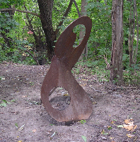
Art along the trail
Ed Freeman talks about the Brickworks
Helen Mills lays footprint ant end of walk
Water from the top was carried to the Brickworks pond
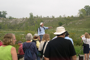
Sunday, September 18, 2005, 10 a.m. First Part of Lost River’s Tenth Anniversary Mud Creek Marathon Walks. We will explore where the headwaters of Mud Creek go now - into Earl Bales Park via the Wilson Heights Storm Trunk Sewer! Earl Bales is the site of a proposed storm water management pond, part of the City’s 25 year plan to clean up our water. It is also a really beautiful spot, and that is where we will eat lunch; (bring your own lunch.) In the afternoon we will trace bits of Burke Brook and the former route of Mud Creek, in the area of Champlain Place. Meet at Downsview Subway Station. The walk will end at the Wilson Subway station. A moderately difficult walk, long with some steep slopes and ravine trails. Leader Helen Mills, who led the first Lost Rivers Walk along Mud Creek ten years ago. Attendance 25; sunny and warm 25C occasional light breeze.
Walking across Downsview prairie
Sunday, September 11, 2005, 2 p.m., American Builders of Victorian Toronto. Start at Summerhill Subway Station. Oaklands; Deer Park. Mostly on city streets. Leader Ian Wheal. Warm 25 C. Attendance 24. 21 C.
Monday, September 5, Lost Ponds of Greenwood ‒ actual sites of seasonal ponds and creeks.
Start Greenwood Av. and Queen St. Leader Ian Wheal. 16 people attended. Warm
21 C.
Sunday, September 4, 2005, 2 p.m., Under Canvas. Military and other encampments at Long Branch; former arseal lands. Start at the streetcar loop at the far west end of the Queen Car Line. Mostly on city streets. Leader Ian Wheal.
Attendance ten; Warm 22 C. This was an exciting site with Great War and Second World War riffle ranges and ordinance manufacture. Observed: 3 creeks, 2 ponds & wetlands, coyotes, lots of birds, amphibians, reptiles lizards etc.
Saturday, Aug 27, 2005, 10:30 a.m. A “Healthy Walk” in Spanish and English to the Rockcliffe Harvest Festival by the Greenhouses and Community Gardens. Meet at Gunns Road and Weston Road, one bus stop north of St. Clair, NW corner. Walk the rich bottomlands of Black Creek, past two TRCA wildflower restorations and site of market gardens of 100 years ago. Visit Rockcliffe where vegetables are grown organically and supplied to senior’s homes and foodbanks in the area and urban agriculture is renewed. The walk ends at the Rockcliffe Harvest Festival sponsored by Parks and Recreation with barbequeue, music, children’s activities and tour of one of the most beautiful community gardens in the city. Leaders Dagmar Baur, York Community Services and Carmen Miloslavich, Casa Dona Juana. Moderate effort to promote well being. More info in Spanish, Carmen 416-828-9561 or Dagmar in English: 416-653-5400, x 294.** Dagmars Report:** It was an extremely successful walk. Over 40 people showed up, the majority Hispanic. Carmen Miloslavich had advertised this walk on “Voces Latinas” Community Radio (1510AM)and a lot of people came out in response to this Radio programme. We started out the morning with some stretches and exercises. We translated all comments into Spanish for all the people involved. Temperature was about 26 C and we started with Sunshine. We gathered at the northwest corner of Gunn’s Road but didn’t leave until 10:55 because some people couldn’t find the starting point. Some went to Gunn’s Road and St. Clair. If I do this walk again I will make the starting point a major intersection. Carmen is from Casa Dona Juana. She organized the walk for Parks and Recreation, and for “Get a Move On,” a public health initiative. Their manager, Barbara, also showed up with a placard saying “Get a Move On” and walked with us. Carmen distributed pedometers to people and a wonderful newsletter in Spanish about stopping Pesticide use and other articles.
We walked down beside Lavender Creek down to Terry Drive. The Sumach is turning ripe, we saw woodland sunflowers, tansy, golden rod, early evening primrose and bindweed in bloom. There appears to have been a fire on the north slope or a dumping of toxic chemicals from a plant because a number of trees and shrubs were dead in that place. At Terry Drive we turned North and continued walking beside Lavender Creek. There were healthy amounts of water in both the Lavender and the Black Creek. We noted a very ancient willow tree still waving gallantly on the meadow going north. I gave people information about medicinal and edible weeds and plants as we walked along. At Black Creek we crossed the bridge and walked west along Black Creek to Rockcliffe Blvd. We passed several lovely plantings implemented by the TRCA. There we crossed the bridge and turned back east and went to Rockcliffe yard. We were greeted by music, good food, organic vegetables etc. and toured the lovely gardens. Over a hundred people from Africa, South America and Canada celebrated at the Rockcliffe Harvest Festival. The walk took about an hour at a very moderate pace.
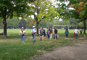
Sunday, August 21, 2005, 2 p.m. Taylor Creek Park; joint walk with FODE. Start at O’Connor and Taylor Drive; end near Victoria Park Subway Station. See the connections between Taylor Massey and other creeks, including the Ferris Ravine and Currity Ravine. There is a great history to this park and its surrounding area, including the many creeks that entered it; some still do. Moderate difficulty along park trails. Leader Martin German. Attendance 8; warm and sunny (a few small cumulus clouds); light brease; 25C; humidex 29.
Walking through Taylor Creek Park
Debris from storm
Sunday, August 14, Burns Creek ‒ tributary of the Humber. Start Weston Road and Steels Avenue. A seldom done walk in NW Toronto; Ian Wheal. 6 people attended; warm 26 C pleasant.
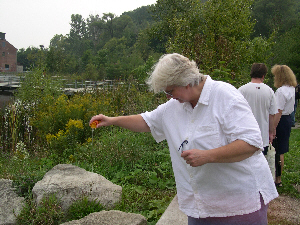
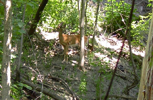
Sunday, August 7, 2005, 2 p.m. Lower Yellow Creek Walk from Davisville and Yonge down to Craigleigh Gardens Joint walk with the Task Force to Bring Back the Don. Leaders John Routh and Peter Hare. This is the April 3 walk that was postponed due to very bad weather. Start at front door of Davisville Subway Station. Attendance 23; 31C; humidex 35; sunny light brease. We saw a DEER in the Vale of Avoca. John Routh took the photo below.
Sunday, August 7, 6:45 pm, ‘The Streets that God Forgot.’ Start Queen St. East and River St. Poverty, pollution, disease, amidst the slums of Old Corktown; Ian Wheal. 20 people.
Sunday, July 31, 2005, 2 p.m. Gangs of Toronto. Meet north entrance St Clair West Subway Station go south along Wells Hill, Wychwood car barns, Toll Keepers Cottage. Leader Ian Wheal. City streets. Four people; 28c.
Sunday, July 24, 2005, 2 p.m. On Toronto’s Railway Frontier. Meet Eglinton St. West at Caladonia Road, NE corner. Beginning of railways, Bert Robinson Park. Leaders Ian Wheal and friends. Attendance 8; 27c.
Tuesday July 19, 2005, 2 p.m. Deer Park Heritage: Old Oaks, other trees local history both natural and built. Discuss heritage tree policy. Start SE corner Avoca and St. Clair (one block east of St Clair Subway Station). Leader Peter Hare. Easy walk along city streets. Atentance 7; sunny some clouds; 31C; humidex 36C.
Resting in Amsterdam Square, July 19, 2005.
Sunday, July 17, 2005, 6:45 p.m. Ramblers Road. Meet SW corner of Carlton and Jarvis at Ramada Hotel, Tom Hotons. Through Allen’s Gardens , past Regent Park across Sumac Creek and River Stree; past Don Jail into Riverdale area. Leader Ian Wheal. City streets. Attendance 13; 29c.
Sunday, July 17, 2005, 2 p.m. North Toronto Gardens in Three Sub-Watersheds. Meet at the SW corner Montgomery Avenue and Yonge Street. Leaders Helen Mills and friends. Difficulty moderately easy on city streets. Attendance 15; 29c.
Sunday, July 10, 2005, 2 p.m. Meadow Creek Meet at Wilson Subway Station entrance. Loop west to Downsview lands a back to end where it started. Leader Ian Wheal. City streets. Attendance 10; 33c; smog.
Sunday, July 10, 2005, 2 p.m. Healthy Walk along the “Hydro Corridor” checking early rail lines community gardens, to Lambton Park. Meet at Jane and Woolner Leaders Dagmar Baur, Beatiz Alas, Steven Joudry and Peter Heinz. Partners York Community Services, and Hispanic Development Council and TRCA. Moderate effort to promote well being. Walk cancelled due to smog allert. 33c. Nobody showed up.
Sunday, June 26, 2005, 2 p.m. Franco-Ontario Heritage and the Construction of the Railways. Start King and Bathurst NW corner. Leader Ian Wheal. How workerws from Quebec and France helped build Ontario’s railways. Attendance 9; 32c.
**Saturday, June 25, 2005, 2 p.m. A “Healthy Walk” to Rockcliffe Greenhouses and Community Gardens. **Meet at Gunns Road and Weston Road, one bus stop north of St. Clair, NW corner. Walk the rich bottomlands of Black Creek, past two TRCA wildflower restorations and site of market gardens of 100 years ago. Visit Rockcliffe where vegetables are grown organically and supplied to senior’s homes and foodbanks in the area and urban agriculture is renewed. Leaders Dagmar Baur, Beatiz Alas, Steven Joudry and Peter Heinz. Partners York Community Services, Hispanic Develoment Council and TRCA. Moderate effort to promote well being. Walk cancelled due to smog allert. 35c. Only 2 persons showed up.
Sunday, June 19, 2005, 2 p.m. Ashbridge’s Bay Watershed Walk led by John Wilson of the Task Force to Bring Back the Don. We will visit several lost creeks in the Beaches area including the lost creek where English settlement of Toronto began in 1791 and end at today’s remnant of Ashbridge’s Bay. This walk is a continuation of the Ashbridge’s Bay Watershed Tour that John lead in May 2003. Starting point: Queen Street East at Neville Park (access via 501 streetcar); ending point: Ashbridge’s Bay, Coxwell and Lakeshore (access via bus route 92 to Woodbine station). Approximate time: 2 1/2 - 3 hours. Difficulty: Moderately strenuous walk on hilly streets and trails with some stairs. Mainly sunny, 19C light breeze, attendance 29.
Sunday, June 12, 2005, 1 p.m. Canada Rivers Day along Highland Creek. Joint walk with Toronto and Region Conservation as part of the Highland Creek Watershed Community Festival. This family-friendly event hopes to raise awareness about the watershed and celebrate volunteer efforts. We are invited to join the festival which will run from 10 am - 2 p.m. and includes a free barbecue for participants. This will take place in Morningside Park; the park access road is off Morningside Avenue, south of Ellesmere Rd. There will be tents next to the park washroom facilities accessed from the first and second parking lots. The walk will start at 1 p.m. at the festival registration tent. Leaders Peter Hare, Bill Snodgrass and others. Moderate difficulty. Attendance 12; warm & muggy 25C but light breezes helped; some sun amd cloud.
Along Highland Creek in Morningside Park 12 June 05
Saturday, June 4, 2005, 2 p.m. Humber River Weston. Start: Entrance to Cruickshank Park, NW corner of Church St. and Weston Rd., Weston; End: Weston Lions Arena, 1 block SW of Weston Rd. and Lawrence Ave. Difficulty mostly level on paths, but 2 dozen stairs down at start. Leader Ed Freeman. Attendance 5; warm, muggy, pleasant when breezy, 26 C.
Monday, May 23, 2 p.m. March into History. Start Bathurst at east entrance to Fort York. Leader Ian Wheal. Attendance 10 Dull cool 12 C.
Sunday, May 22, 2 p.m. Riverdale Wildflowers andWetlands. Start Pape & Gerrard SE corner. Leader Ian Wheal. Great Walk assited by Richard Anderson and Ed Freeman; Attendance 33, partly sunny, light wind.
Sunday, May 15, 2005, 1:00 p.m. Agnes Dunbar Moodie Fitzgibbon’s Wildflowers. Meet at the historic Lambton House, 4066 Old Dundas street West, on the east bank of the Humber River. This walk is based on the floral information in illustrations for her 1868 book “Canadian Wildflowers.” We will pass through some of the same spots frequented by the illustrator a century and a half ago. Moderately easy. Leader Madeleine McDowell. Attendance 36; sun and cloud breasy 14 C.
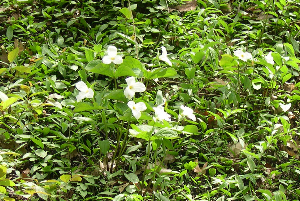
A few of the many trilliums seen
Sunday, May 15 2-4 p.m. The Burke Brook - Don River Connection. This is a Task Force to Bring back The Don walk. This walk will start and end at the main entrance to Sherwood Park (limited parking available) at the eastern end of Sherwood Avenue 200 metres east of Mt. Pleasant Rd. Join a Task Force to Bring Back the Don member, Janice Palmer, to explore part of Burke Brook, a tributary of the Don River and observe how the health of both Burke Brook and the Don River are influenced by neighbourhood activities. Attendance 17; sun and cloud breasy 14 C.
Hike Report - Sherwood Park - May 15, 2005
Seventeen people joined Janice Palmer, a member of both the Task Force to Bring Back the Don and the Sherwood Park Advisory Committee, to learn about the park, Burke Brook, and how actions of local residents have an affect on the health of the park and the Don Watershed.
Two participants knew of the hike through the Task Force Habitat Restoration Team. None of the other 15 had read about it in the Task Force newsletter. Most had read about it in the Lost Rivers website or brochure. Other saw it listed in the Town Crier.
Participants were led past several homes and small apartment buildings on Sherwood Ave. and asked to assess the porosity of the front yards with respect to wet weather flow management. Both good and very bad examples were noted.
The pattern of run-off was noted throughout the park as related to the paved service road, steep slopes, fenced forest slopes, bare forest trails, elevated stairways, various encroachment issues, boardwalks through seepage areas, restricted flow under the bridge, one giant storm sewer opening, and the place where Burke Brook goes underground under Mount Hope Cemetery.
Participants were eyewitnesses to some of the causes of the problems. They also assisted other park users by removing a fallen limb from the trail to the forest area.
White trilliums and one Jack-in-the-pulpit were observed as well as an abundance of garlic mustard, both first and second year plants.
Saturday, May 14 -11 a.m. Ecological Tour of Riverdale Farm Ponds. This is a Task Force to Bring back The Don walk. Join Task Force to Bring Back the Don member and Riverdale Farm Pond Stewardship leader, Aynsley Morris, to explore the plants and animals of the lower ponds at Riverdale Farm. The 1-1.5 hour tour will start and finish at the Riverdale Farm entrance on Winchester. Street parking is possible or walk three blocks north from the TTC stop at Queen and Sumach. Learn how the ponds were originally formed, their former purposes, and the changes that have made them more natural and attractive to wildlife. Find out what on-going maintenance is required and how you can be involved. Please wear suitable footwear for climbing steep hills.
There were over 20 people on the walk (yikes), probably half of which were from the Ecological Restoration and Habitat course at York University. The prof had provided the students with a list of walks and they had to write a short essay about them. It had threatened to rain in the morning but it was warm and sunny by the time the walk started. The NEHS team had just completed a planting so it was good to be able to demonstrate restoration “in action”. (19 C; 6.2 mm @ Malton)
Saturday, May 14, 2005, 2:00 p.m. Dalton Shipway’s Twentieth Annual Don River Walk. Meet at Broadview Subway Station. Walk the lower Donlands ‘till 4p.m. Discussed the “Meaning of what Bringing Back The Don” means. Moderate difficulty. Attended by 45 enthusiastic people; 19 C; 6.2 mm @ Malton.
Sunday, May 8th, 2005, 2 p.m. Healthy Walk along the “Toronto Carrying Place” which was a native trade route for millenia. Also included are the Foxwell allotment gardens, a remnant of the Oak Savannah and the successful TRCA wetland restorations and waterbirds in Smythe Park. Meet at Jane and Woolner finish at Jane and Alliance at Tim Hortons. Leaders Dagmar Baur, Beatiz Alas, Peter Heinz, Steven Joudry and Madeleine McDowell. Partners York Community Services, and Hispanic Develoment Council and TRCA.Moderate effort to promote well being. Attendance 12; beautiful day; saw ducks and red-winged blackbirds (22 C; fair @ Malton).
Sunday, May 8 11a.m.-1p.m. Visit Current and Future Forests in the Don Valley. This is a Task Force to Bring back The Don walk. Join two Task Force to Bring Back the Don members, Debbie Supran and Martin German, for a circular walk to learn about an existing valuable forest, Crothers’ Woods. Also visit the Sun Valley site of a future forest. Leaders will discuss the ecological significance of these areas and the impact of snow dumping, future sewer construction, and various other personal human uses. There is a TTC stop at Millwood Rd and Redway Rd. (called Village Station Rd. to the north) Walk or drive south along Redway Rd. Cross the Loblaws parking lot and find a sign ‘North Toronto Treatment Plant’ just past the main store entrance. Follow the steep and winding road and meet at the bottom. Limited parking is available here. Actual leader John Routh. There were 5 attendees including one elderly lady from TFN and Ed Freeman. I think the low turnout was due to the difficult to access starting location. (22 C; 0 mm @ Malton)
Sunday, April 17, 2005, 2 p.m. Rowntree Mills Wetlands. There are several small interesting wetlands in this area. Joint walk with ARCH. Leader Luciano Martin. Moderate difficulty, can be somewhat wet. Meet in Rowntree Park Parking, lot off Islington just north of Finch NW corner. Attendance 28; Cloudy warm 20C, some sun.
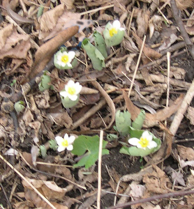
Patch of Blood Root seen along the Humber.
Saturday, April 16, 2005, 2 p.m. Green Railways and Sir Edmond Osler. Meet SW corner Dovercourt and Queen. Leader Ian Wheal. Warm and sunny 19C; 24 people; warm and sunny 19C, little wind.
Saturday April 16 - 10 a.m. Don Valley Points of Interest. Tour and learn about Todmorden Mills, Crothers’ Woods, and the Don Valley Brick Works with two Task Force to Bring Back the Don members, Dave Tyson and John Routh. Meet at the Broadview subway station. This 11 km walk will be at a moderate pace and include a break for lunch. Be prepared for muddy, variable terrain. No dogs., please. The walk will end at the Davisville subway station or the Bow and Arrow Pub a short distance north. This is a joint Task Force to Bring back The Don and Toronto Bruce Trail Club walk. Over 60 attended; warm and sunny 19C, little wind.
Sunday, April 10 11a.m.-1p.m. Restoration Sites in the Don Valley
Join two Task Force to Bring Back the Don members, Debbie Supran and Martin
German, for a circular walk to learn about the past, present, and future
restoration work at Beechwood Wetland. Find out how the on-going stewardship
team at this site operates. Also visit the Sun Valley site. Leaders will
discuss the ecological significance of these areas and the challenges
presented by human use and invasive species. Discover how your actions can
help improve the Don. There is a TTC stop at O’Connor and Beechwood Drive.
Walk or drive down Beechwood Drive (steep and winding), go under the DVP, turn
left, (not right to the Toronto Police Dog Services) and meet at the large
boulder. Limited parking is available here. This is a Task Force to Bring back
The Don walk. Twenty seven people attended, all ages, children to senior
citizens; sunny and warm 18C.
Sunday, April 3, 2005, 2 p.m. Lower Yellow Creek Walk from Davisville and Yonge down to Craigleigh Gardens Joint walk with the Task Force to Bring Back the Don. Leaders John Routh and Peter Hare. Start at front door of Davisville Subway Station. This was a blustery,cool (3 C) day with rain and snow falling. The overnight snow had made walking treacherous. Only 3 people plus the leaders showed up so it was decided to cancel this walk and plan another in the fall. One leader and a friend decided to take an “alternate route” to a local house of good cheer. the rest went home.
Sunday, March 20, 2005, 2 p.m. Landfilling and Lost Ravines in the East End. We explore the lost rivers and ravine systems of Small’s and Tomlin’s Creeks, including areas of pre-1955 landfilling, remaining fragments of natural ravine. If we feel energetic we may cross over to the ravine of First Brook, where more dumpsites and a murder scene are to be found. Leader Richard Anderson. Moderate difficulty about 4 km. Good public transit access. Starts: NW corner Orchard Park Blvd and Queen St E. Attendance 41, dull day 5 C.
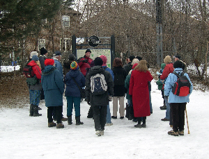
Sunday, February 27, 2005, 2 p.m. Caves and Outlaws of Hillcrest. Meet NW corner Bathurst Street and Davenport Road, Tollkeeper’s Cottage. Animal dens, hideouts, fissures and caves on the bluff slope (1852). Moderately difficult walk. Leaders: Ian Wheal, Dick Watts, Ed Freeman & George Hume. Attendance 43, Weather cloudy cool some sun, -2c light wind some slippery sections.
Sunday, February 20, 2005, 2 p.m. Yellow Creek Walk along the Beltline from Eglinton West Subway Station to Davisville and maybe further. Leader Roger Powley. Easy walk. 32 people; cloudy cool -5C odd snow flake.
Roger Powley leads walk along the Beltline
Saturday, February 12, 2005, 2 p.m. Burke Brook Tributaries around Lawrence and Yonge. Leaders Helen Mills and friends. Moderately easy. Meet at Locke Library, SE corner Lawrence Ave. and Yonge Street.
Attendance aprox 45. We would like to thank the staff of Locke Library for their spontaneous and generous hospitality. They really made this walk something special. Quite a few walkers came because of the Locke Library poster, including the great nephew of Sandford Fleming! It was quite wonderful to be able to show books and maps in a sheltered place. Also they helped us “defrost” with coffee and donuts, really very very pleasant for the group! (max 3.7 C; precipT @ Malton)
Sunday, January 16, 2005, 2 p.m. Lower Garrison Creek. Meet at NW corner Bathurst and King. Easy city streets. Leaders Ian Wheal and friends. 22 people attended. Cold with some wind -10 C. Fast paced & ended in a warm bakery.
Saturday, January 8, 2005, 1:30 p.m. Nature Inside along “The Path.” Meet at Yonge and Queen SE corner. Easy city streets. Leader Ian Wheal. 11 people attended. Blustery and damp -5 C.